MLS Area Maps
OTTO MAPS MULTIPLE LISTING SYSTEM MAPS (MLS MAPS):
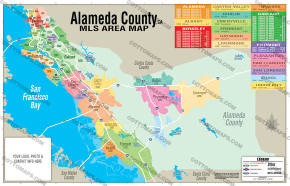
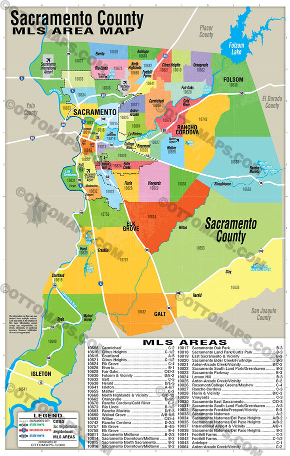
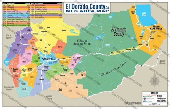
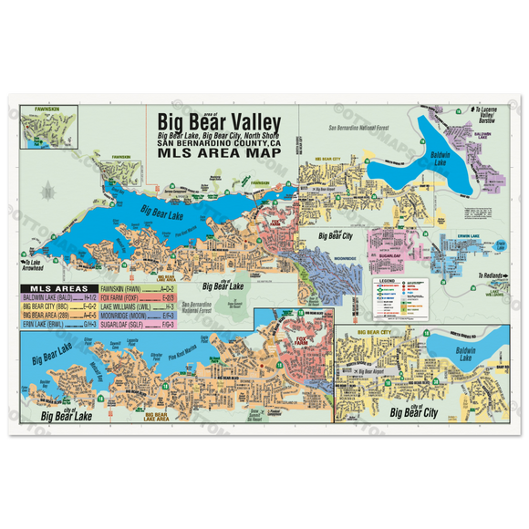
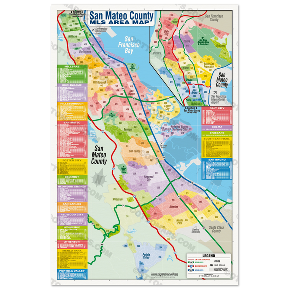
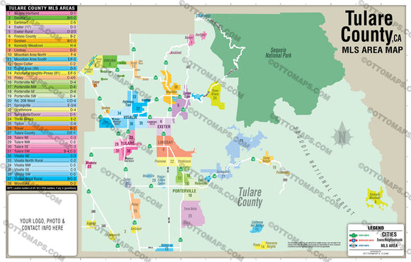
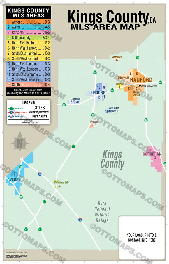
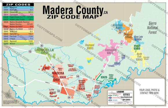
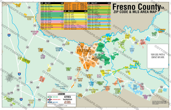
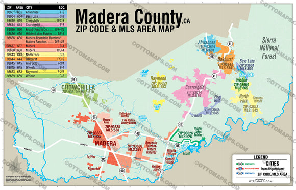
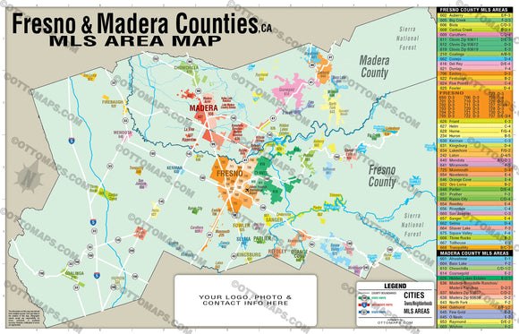
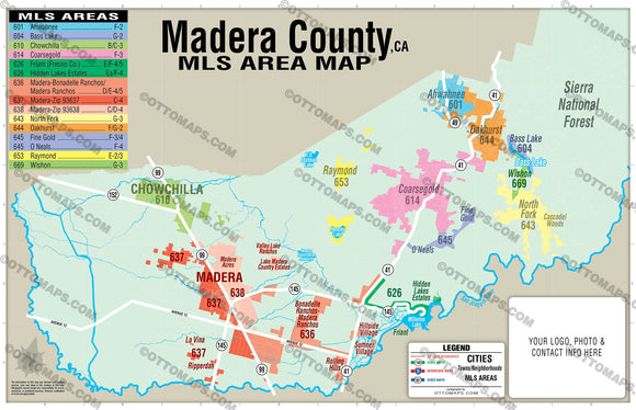
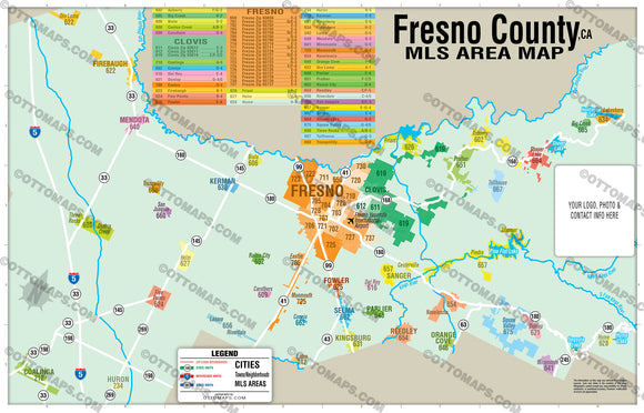
- The Multiple Listing Service (MLS) is a database that real estate brokers use to share data about properties for sale. MLS AREAS are specific regions within which real estate agents and brokers list their properties for sale.
- Boundaries, numbers and index for all MLS Areas.
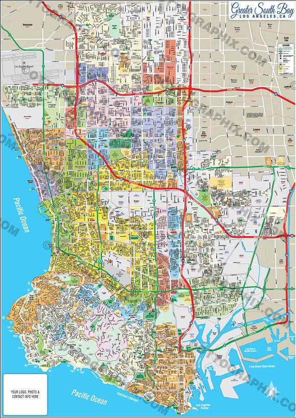
- County level maps with arterial detail (highways and major roads).
- Add your contact info and print the maps as many times as you want.
- Otto Maps are often kept as tools and become long-term advertising
- Compare our costs to a full page magazine ad (approx 2K for 1 issue).
EASY INDEXING LOCATING SYSTEM:
- Each entry is alphabetized, color coded and in numerical order.
- Find what you are looking for alphabetically in the index.
- Example: #1 - DOWNTOWN - F-2
- Use the location grid around the edges of the map to find F-2.
- Then go to F-2 and locate the blue #1.
PURCHASE INCLUDES:
- PDF Files - with Company Branding Box and without
- Adobe Illustrator Files and fonts (layered, editable)
- 11”x17” Vector File - enlarged to any size with out loss of quality
- Files are editable with any PDF editor
- Royalty Free / All Reproduction Rights Granted (not for resale)
- Prints not included, recommend Vista Print
- No sales tax!
MAP DETAILS:
- Multiple Listing Service boundaries and index
- Arterial Detail: Highways and Major Roads
REQUEST A MAP:
Don't see the map you want? Request it here
BUNDLE AND SAVE WITH BULK DISCOUNTS:
- Buy 2-4 maps 15% Off OTTOMAPSBULK15
- Buy 5-9 maps 20% Off OTTOMAPSBULK20
- Buy 10+ maps 25% Off OTTOMAPSBULK25
RIGHTS:
- Royalty Free
- Not for resale
- All reproduction rights granted